- Data and Data Management
Content
Data management
Quicklooks of NOAA/AVHRR images
The 10 Minutes pan-European
Land Use Database
- Introduction
- The development of a consistent methodology
to derive a land cover database from remotely sensed information involves
a considerable amount of data sets and information. The data consists of
satellite as well as ancillary data, collected from numerous sources in
various formats. In order to manage and share the data in an efficient
manner, an overview of the available data is needed as well as access to
the data. Metadata (information about data) will provide the necessary
information on the data and an Internet site provides the means to access
the data.
- Metadata
- The Interface
Information on important aspects of
the project has been facilitated by the PELCOM homepages. Chapter 9.3 will
describe the various components of the PELCOM homepage (Central Project
Information Exchange System or CPIES)
As explained, metadata is used to describe the available project data. For the selection of relevant metadata elements, several initiatives undertaken to arrive at standards in meta information, such as the CEN/TC287 European Standard, the Dutch National Clearinghouse and the standard used by the Federal Geographic Data Committee (FGDC), were compared. From these standards a selection of elements has been made. Table 5.1 lists the elements of the metadata used to describe a geographic dataset.
This list of elements should however no longer be used as common new so-called metadata cores have been developed. The DUBLIN CORE set of metadata elements has been established as an interdisciplenairy set of metadata elements for electronic discovery. The ESMI project has defined a core set of metadata elements specifically for geographic data based on a common set of metadata elements from the new CEN98 model, the FGDC model and the most recent draft of the ISO metadata standard.
For the record, the metadata elements selected for the PELCOM project
are listed below.
Table 1, elements of metadata
|
|
|
M = mandatory O = optional |
| Dataset identification | Identity of this entry (for future update) | M |
|
|
The unique name of the dataset within the owning organisation(s) | M |
| Alternative title | Dataset name as known by Distributor | O |
| Dataset overview | ||
|
|
A brief summary of the content of the dataset | M |
|
|
A summary of the intentions with which the dataset was developed | M |
| Online Linkage | The name of an online computer resource that contains the data set. Entries should follow the Uniform Resource Locator (URL) convention of the Internet. | O |
| Sample | An example taken from the dataset being representative for the whole dataset. Reference to a browse graphic URL or a browse graphic caption. | O |
| Presentation Form | The form used to present the data, for example map, model, diagram, remote sensing image | O |
| Supplemental Information | Supplemental | O |
| Extent | ||
| Currency of extent data and completeness of dataset | ||
|
|
The date of creation of the dataset | M |
|
|
The degree to which the dataset meets its proposed final extent. | M |
| Edition | Edition of the dataset | M |
| Maintenance | Inteded dataset maintenance and update frequency | O |
| Reference | ||
| Currentness reference | The basis on which the time period of content information is determined. For example ground condition or publication date. | |
| Planar extent | ||
|
|
||
|
|
Minimum latitude decimal degrees | M |
|
|
Minimum longitude decimaal degrees | M |
|
|
Maximum latitude decimal degrees | M |
|
|
Maximum longitude decimal degrees | M |
| Geographic area | ||
| Name of areal unit | Name of the areal unit which is covered in the dataset | M |
| Id code of areal unit | Identifier of the areal unit which is covered in the dataset | O |
| Temporal extent | ||
|
|
The earliest date to which the dataset corresponds | M |
|
|
The latest date to which the dataset corresponds | M |
| Data definition | ||
| Spatial characteristics | ||
|
|
Description of the geometric primitives used in the dataset. Definded as point, vector, raster. | M |
| Administrative Metadata | ||
| Distribution Organization | ||
|
|
The name of the organisation that distributes the data | M |
|
|
The postal address, telephone, telefax number, e-mail address of the organisation | M |
| Point of contact | ||
|
|
The name of the person acting as the point of contact | M |
| Distribution | ||
|
|
Constraints regulating the access and usage of the dataset, other than copyright | M |
| Publisher | ||
| Organization | The name of the organization that published the data | O |
| Publication Place | Place where the data were published | O |
| Metadata reference | ||
|
|
Orginator Metadata entry | O |
|
|
Date when the metadata was created or last updated | M |
Figure 5 shows the interface for gaining access to the metadata system. A username password combination provides access for each user to the datasets entered by this person. Only the project partners are allowed to enter and change metadata. The user is prompted for a username and password in the first screen. The form offers the possibility to submit a new dataset or to update an existing dataset. In the first screen the user has to pick one of these options. If an existing entry has to be updated the user is asked to select an entry from a list of available entries.
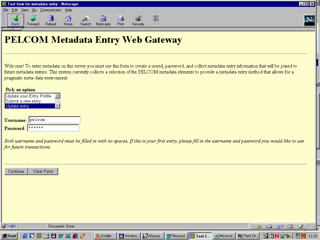
Figure 5, metadata user access form
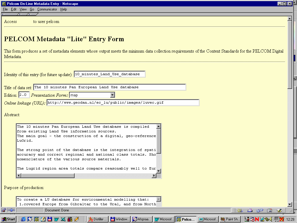
Figure 6 shows the first fields of the actual Metadata "Lite" Entry form. All metadata elements are combined in one single form.